What 61,000 hidden structures reveal about Maya civilization

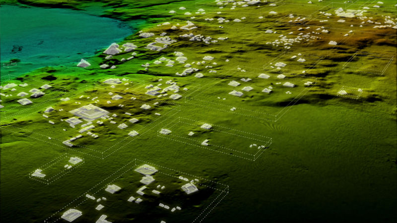
Enlarge / Mapping the Maya landscape. (credit: 21st Century Fox)
Earlier this year, a team of archaeologists announced the discovery of more than 61,000 long-lost Maya roads, fortresses, drainage canals, and buildings hidden beneath the dense green canopy of northern Guatemala’s tropical forest. The findings were the result of an airborne laser, or lidar, survey of 2,144 square kilometers of the Maya Biosphere Reserve. Now, archaeologists are starting to piece together what all the data actually says about Maya civilization. The picture emerging from beneath the jungle canopy is of a much more complex political and economic landscape than we previously realized.
“In February, you were really getting our first impressions as we began exploring the data, which was filmed by National Geographic. The Science article is about putting actual numbers behind those first impressions,” Ithaca College archaeologist Tom Garrison told Ars Technica.
A network of cities
Garrison, with archaeologists Marcello Canuto and Francisco Estrada-Belli of Tulane University and colleagues, used the lidar survey data to estimate that a Mayan population of between 7 million and 11 million people lived in the central Maya Lowlands (parts of the Yucatan, Guatemala, and Belize) in the bustling Late Classic Period between 650 and 800 CE. With 29 structures per square kilometer in the survey area, and evidence from earlier excavations to suggest how many of those structures might have been houses, the team calculated an average of 80 to 120 people per square kilometer. The overall number lines up well with estimates from previous studies, even though it was derived independently.
Read 20 remaining paragraphs | Comments
https://arstechnica.com/?p=1384043


