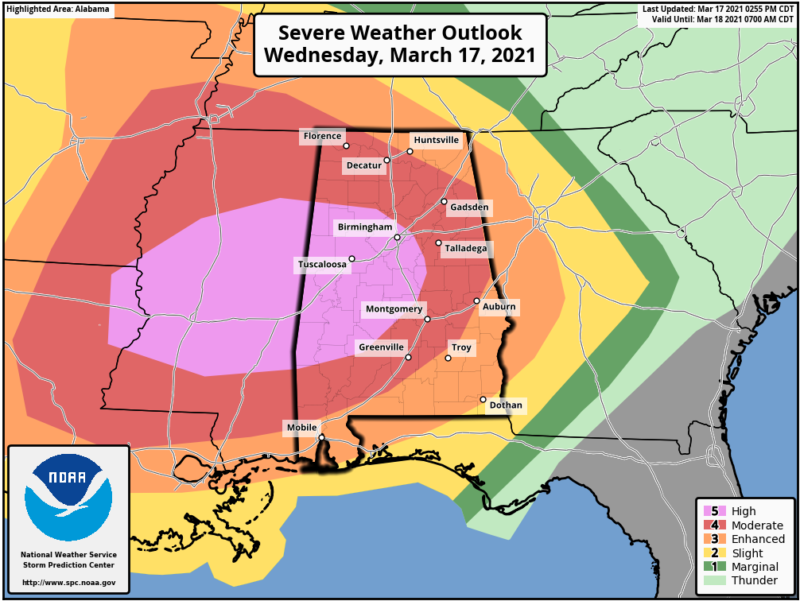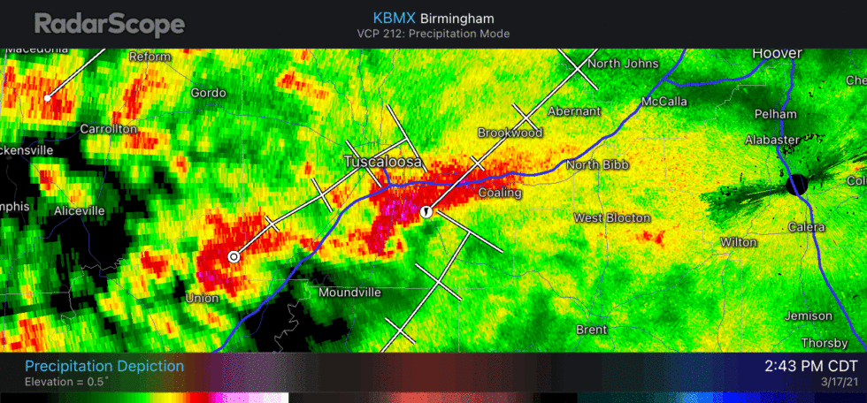
An extraordinarily severe weather outbreak is underway across the southern United States today, with several tornadoes already developing in Alabama. More are expected there and in nearby US states later during the day and overnight.
NOAA’s Storm Prediction Center took the step of issuing a rare “high” alert for its severe weather outlook, which it has not issued since 2019. The last time NOAA issued a “high” alert in March was 2012. At the center of NOAA’s warning area, there is an exceptionally high “45 percent” contour in which a given location has a 45 percent chance of a tornado passing within 40 km.
This event is being driven by a strong upper-level trough, with an attendant surface cold front advancing across the southern United States and colliding with a warm air mass, modified by the Gulf of Mexico. Where these air masses are meeting, there are violent upward currents of air, known as updrafts, that transport moist air high into the atmosphere.

A capping inversion often helps to inhibit this upward motion—a “cap” exists where the temperature is warmer at several thousand meters above the surface than at the surface. In this case, there is not much of a cap, or it is quickly eroding.
As a result, there are widespread storms in Mississippi, Alabama, and other southern states today, with a second round developing tonight. Some of these super cell storms are already producing hail and tornadoes.
These southern states often see the greatest incidence of tornadic activity in February and March as winter air masses collide with the warmer Gulf of Mexico air. Peak season for the Plains states, including Oklahoma, typically comes later, from April to June.
There is also emerging evidence that tornadic activity is higher during a La Niña, which we are presently in, with cooler than normal temperatures across the equatorial Pacific Ocean. This tends to concentrate warmer air and more humidity over southern states, as is the case with the situation helping to fuel today’s outbreak.
https://arstechnica.com/?p=1750445

