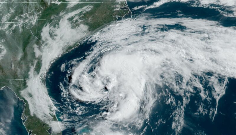
The Atlantic hurricane season’s first named storm formed late Saturday night off the eastern coast of Florida, when its sustained winds reached 40mph.
Named Tropical Storm Arthur, the system should move north-northeast for the next couple of days. Although there is a fair amount of uncertainty about this motion, Arthur should come near, or just over, coastal North Carolina, where tropical storm warnings have been raised. After this Arthur is likely to bend due eastward, away from the mainland United States and out to sea.
Because of low wind shear and moderately warm waters, Arthur may remain a tropical storm and even strengthen a little before succumbing to cooler waters later this week. The National Hurricane Center forecasts the system to reach maximum sustained winds of 50mph on Monday.
An earlier start
The Atlantic hurricane season officially begins two weeks from now, on June 1, and runs through November 30. Historically, it is not all that unusual for a tropical or subtropical storm to form before June 1 and become named after reaching sustained winds of 40mph. This happens, on average, about every two to three years.
However, this is now the sixth year in a row that a named storm has developed prior to the June 1 date. And according to data compiled by University of Miami hurricane scientist Brian McNoldy, the average date of the first named storm is steadily moving earlier. In 1970, it typically came in early July, but now the average date of the first storm is about one month earlier. There has been some discussion in the hurricane community about moving the start of the Atlantic season up to May 15 to match the beginning of the Eastern Pacific hurricane season.
The reasons for the earlier date appear to be two-fold. Hurricane scientists now have more access to satellite and other observational data over the Atlantic Ocean and so are more inclined to find and name storms. Another significant factor is the warming of sea surface temperatures in recent decades due to climate change, allowing for earlier development.
Overall, seasonal hurricane forecasters have predicted that the 2020 Atlantic season will be a rather busy one, with warmer oceans and what may be a weak to moderate La Niña, which tends to increase Atlantic activity. So while Arthur is the first named storm of 2020, it will be far from the last.
https://arstechnica.com/?p=1676687

