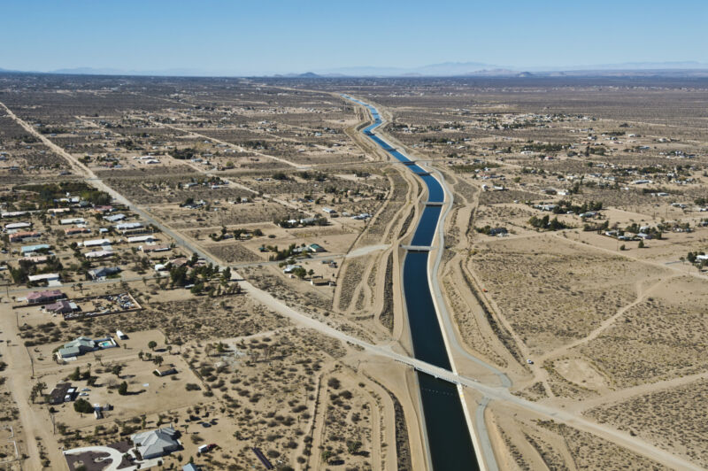
Over a third of American vegetables are grown in California, largely in the state’s Central Valley. The region also produces two-thirds of the nation’s fruits and nuts. These crops—and the many Americans who produce and consume them—are heavily reliant on California’s water supply. But, given recurrent and severe droughts, the state’s groundwater supply has been strained.
When surface water supplies run low, most arid regions worldwide turn instead to their groundwater. But past mismanagement of the groundwater in California has caused parts of the state to sink as much as 30 feet and has also increased the frequency of earthquakes along the San Andreas fault.
Just as importantly, the state’s groundwater storage may have been depleted to a point where recovery may take many decades. But, given that this supply is—as its name suggests—in the ground, changes to groundwater aren’t the easiest to measure; the available approaches each have advantages and disadvantages. A new study uses a combination of four of the leading methods to show that California’s aquifers haven’t been recovering from overdrafts during the droughts over the last two decades—and they’re unlikely to do so unless policymakers put more limits in place soon.
Measuring a hidden resource
Past groundwater depletion estimates have typically relied on one, or maybe two, approaches to estimating water supplies. But, in this latest study, the authors suggest that using a combination of multiple methods can give a better picture of how much ground water has been used and how quickly it’s being replenished. The four methods the researchers relied on included gravitational measures; the actual water-level measurements of wells; a newly developed water balance approach; and a hydrologic simulation model.
Through the data collected by NASA’s GRACE satellites (Gravity Recovery and Climate Experiment), it’s possible to detect groundwater loss via the small change in gravity that results from the decreased mass. These measurements have been continuous since the start of the program in 2002 and encompass the entire valley. However, the weakness of this approach is the resolution of the measurement footprint, which precludes more detailed information on a smaller scale. Well measurements are at the other end of the spectrum—they are very localized, but continuous datasets are rare and coverage is scattered. Inconsistent use of aquifer storage coefficients has also caused some uncertainties in well-based calculations.
Water balance approaches aim to estimate the complex mix of all of the ways that water flows into the system (via rain, rivers, etc.) and out (also by rivers, evaporation, use, and many more ways). Each of the factors are challenging to estimate, and the uncertainties increase as they’re combined. Hydrologic models use similar data and are likewise subject to uncertainties, but they are also particularly useful for predicting groundwater responses to potential future scenarios, such as the increasing frequency of droughts.
Slow recovery, if any
“Using a multi-model ensemble like what we did [provides] a robust estimate and should be considered for estimating groundwater storage change in future investigations,” the first author, Dr. Sarfaraz Alam, wrote in an email to Ars Technica.
In combination, these different approaches created a more comprehensive and reliable estimate of what’s been happening to California’s groundwater storage, including forecasting how slow the recovery is likely to be under different climate scenarios. The median of the four methods showed that there was an estimated loss of 19 km3 of water during the 2007-2009 drought and 28 km3 during the 2012-2016 drought. In the years following each of these droughts, the aquifers regained only 34 percent (from 2010-11) or 19 percent (from 2017-2019) of the volume lost.
Unsurprisingly, the simulations showed that if the climate patterns of the last two decades continue, there’s little chance (<20 percent) of reaching prior levels of groundwater within the next 20 years. Even under best-case scenarios with above-average precipitation, the researchers estimate that it would take six to eight years to replenish the aquifers. But given recent weather patterns, such rainfall seems unlikely.
Implementing even modest pumping restrictions shows the potential to cut these recovery times by half, and the authors suggest that their results and methods could be used to inform more sustainable management practices. Such restrictions, of course, continue to meet resistance from the agricultural industry, but finding a balance will be critical for California’s future.
“The recovery time under current climatic conditions is very high and there are very low chances of recovering the overdraft under business-as-usual conditions,” wrote Alam. “Climate change will potentially make it even harder to recover groundwater overdraft and so it is a critical time to take the necessary initiative to reduce the overdraft during drought events.”
Water Resources Research, 2021. DOI: 10.1029/2021WR030352
K.E.D. Coan is a freelance journalist covering climate and environment stories at Ars Technica. She has a PhD in chemistry and chemical biology.
https://arstechnica.com/?p=1822105

