Last year’s Atlantic hurricane season ranked among the top five most-active years on record. Its third named storm, Chantal, did not form until August 20.
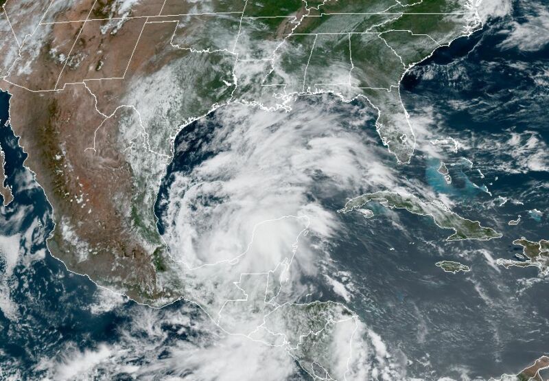
By contrast, today is June 2, and the Atlantic’s third named storm of the year just formed. At around noon Eastern, the National Hurricane Center named Tropical Storm Cristobal—a system wobbling around the Southern Gulf of Mexico with 40mph winds.
This is the earliest ever in the Atlantic season (which, however imperfect, has records dating back to 1851) that the third named storm has formed in a given year. The previous earliest “C” storm was Colin, on June 5, 2016.
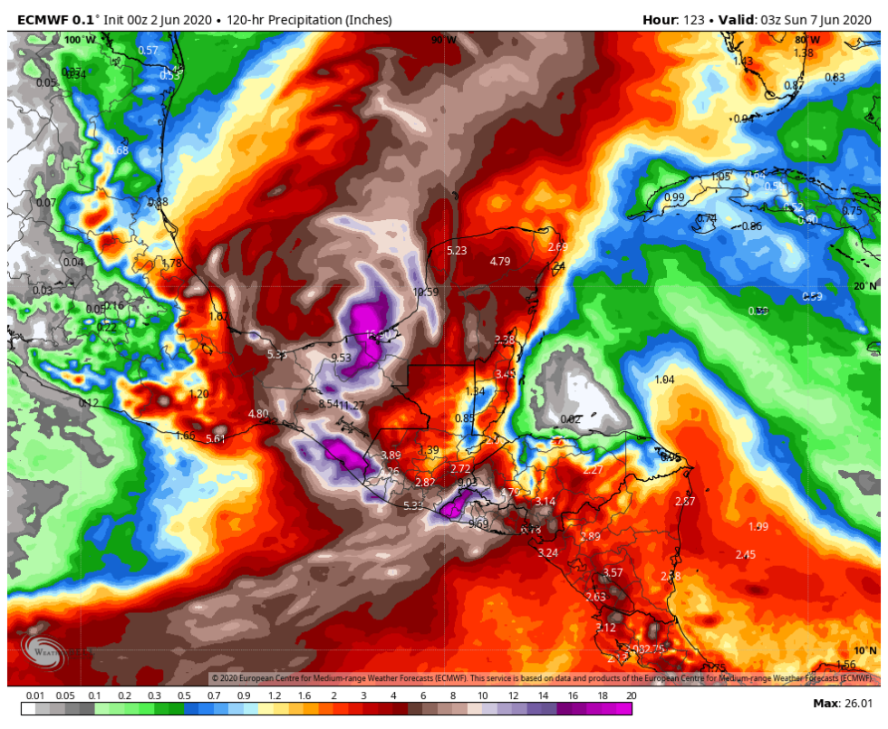
And Cristobal is likely to be more than a historical curiosity. The storm is trapped within a large oceanic circulation, known as a gyre, and high pressure over the northern Gulf of Mexico is also inhibiting its motion. As a result, Cristobal will probably wobble around the Bay of Campeche until at least Friday. This will cause torrential rainfall in Southern Mexico and parts of Central America this week.

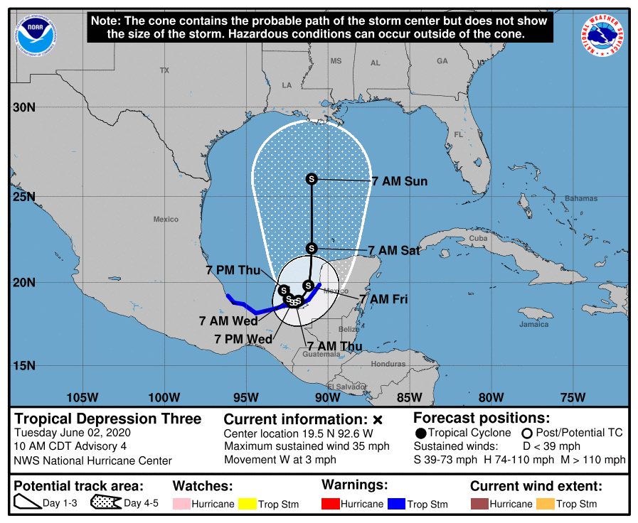
By Friday or Saturday, Cristobal should find enough of a weakness in the high pressure ridge to move north into the Central Gulf of Mexico and toward the United States. By Sunday morning, the National Hurricane Center estimates Cristobal will have become a strong tropical storm with sustained winds of 65mph. But there is a huge amount of uncertainty about this because it is unknown how much time, if any, the wobbling center already near the coast will spend over Mexico during the next few days. A prolonged period of time over the state of Tabasco or other areas could substantially disrupt the storm’s circulation.
However, by this weekend Cristobal should be moving toward the United States in some form. Much as there is with the storm’s intensity, uncertainty also abounds about Cristobal’s track. Ensembles from the major global models generally show a track toward Louisiana, but it is way too early to rule out the storm turning more northwest, toward Texas, or farther east toward the Florida panhandle.

The bottom line is that a tropical system is likely to be in the Gulf of Mexico late this week, bound for the United States, over waters warm enough to sustain intensification. The time for preparations is definitely now.
https://arstechnica.com/?p=1680626

